 ™
™The Santa Monica Pier Loses Its PCH Ramps September 28. Every Way In, Priced.
Moomat Ahiko Way closes for about two months. The beach lots stay open — from Ocean Avenue, not the highway.
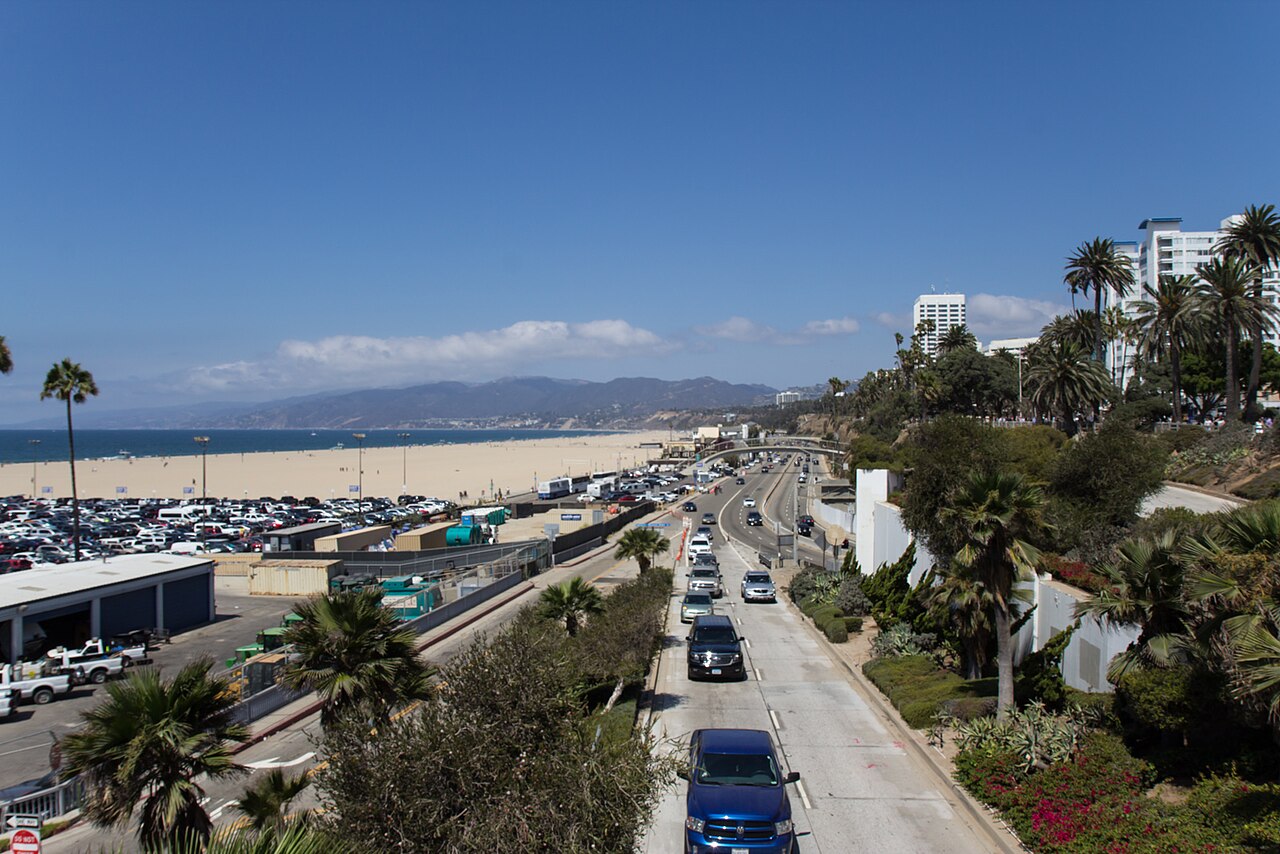
You're wondering whether the Santa Monica Pier is closing. It isn't. What closes on Monday is the pair of ramps that link Pacific Coast Highway (PCH) to Moomat Ahiko Way, the road that runs under the pier between Ocean Avenue and the highway — and the city says they'll be shut for about two months, starting as early as Monday, Sept. 28. The pier stays open the whole time. Getting to it by car gets longer.
The reason is the bridge. Crews are demolishing the last stretch of the old Santa Monica Pier Bridge — the city calls it the largest portion taken down since the project began — and then pouring the columns the new span will sit on. The closed ramps become the work yard. The city's construction page puts drilling and demolition on weekdays from 5 a.m. to 1 p.m., which is worth knowing in both directions: the noise is a morning problem, and so is the traffic.
If you're driving, the highway is the part that changed
The city's notice gives two detours, and they're the ones to follow. Southbound on PCH, you either exit at the California Incline — the ramp up to Ocean Avenue, north of the pier — or you stay on and continue onto eastbound Interstate 10 to Lincoln Boulevard. Going the other way, if you're on Ocean Avenue trying to get down to PCH, you drive north to the Incline instead of down Moomat Ahiko Way. There's no third option for two months. A detour map is on the project site.
None of that closes the beach lots. It closes the shortcut to them. The lots by the pier sit on Appian Way, which you reach from the surface streets: off Interstate 10, the pier's own directions run you to Fourth Street, left on Colorado Avenue, then Ocean Avenue, Seaside Terrace and Appian Way. That route never touches the ramps.
The three lots the city names, and what they cost
The construction page tells drivers to use three facilities during the closure. Here's what each one charges, from the city's own posted rates.
Beach Lot 4 South, 2030 Ocean Avenue, open 6 a.m. to 9 p.m. It's $12 on a weekday and $15 on a weekend, and — this is the part that matters for the next two months — that price doesn't change on Nov. 1, because Lot 4 South charges the same in winter as in summer. There's a short-term rate of $3 through October and $2 after. Placard holders pay half. It's the southernmost of the three, and the only one you can reach without going near Pacific Coast Highway at all.
Beach Lot 3 North, 1150 Pacific Coast Highway, open 6 a.m. to 9 p.m. Right now it's $20 for the day, any day, because the city's summer rate runs April 1 through Oct. 31. On Nov. 1 it drops to $8 on weekdays and $12 on weekends. Buses pay $120 in summer. The address is the catch: it's on PCH, north of the closure, so the Incline is how you get there.
Parking Structure 8, 1555 Second Street, downtown. The first 90 minutes cost $1. Ninety minutes to three hours is $3 on a weekday and $4 on a weekend; three to five hours is $10 and $12; past five hours you're at $20 and $22. That makes it the cheapest short stop in the neighborhood by a wide margin and the most expensive long one. It's a block west of the Third Street Promenade, and it's the only one of the three that isn't a beach lot.
Beach Lot 1 North, the big lot right at the pier, is open. It is also the construction yard: when the project started, the city said about a third of the lot would be taken for staging, leaving roughly 726 spaces. Its posted rate is the same $20 through Oct. 31, then $8 and $12 — and we've written before about how late Santa Monica's winter arrives next to the county's, which flips its own lots to winter prices on Sept. 28, the same day these ramps close.
The cheapest way in doesn't use a ramp
A ride on the Metro E Line is $1.75, and the fare stops adding up after three rides: Metro caps a day at $5 and a week at $18, so a round trip from anywhere on the line is $3.50 and no parking decision at all. The line ends at Downtown Santa Monica station, and the pier's own site calls it a ten-minute walk from there.
Big Blue Bus is cheaper still. A one-way ride is $1.25 if you tap a TAP card, a credit card or a phone, $1.50 if you pay cash, and the contactless fare includes one free transfer to another Big Blue Bus within two hours. A day pass is $4.50. Seniors and riders with disabilities pay 60 cents contactless. The pier's site points visitors to Route 8, which stops at Ocean and Colorado — the corner at the top of the pier's entrance.
Two sets of posted directions haven't caught up
Read the construction page closely and you'll find a line that says vehicle access to the pier "will remain available from Pacific Coast Highway (PCH) throughout the closure." That sentence sits under the heading about Appian Way, and it was true of the earlier closures it was written for. The notice the city posted on Sept. 24 is the newer instruction, and it's the specific one: southbound PCH drivers exit at the Incline or ride the freeway to Lincoln. Follow the notice.
The pier's own directions page has the same lag. It still tells drivers coming south on PCH to stay right after the Incline and take the right-most lane before the McClure Tunnel to enter the beach lot — the maneuver the closure removes. Its instructions from the 10 are fine. Its instructions from the highway are not, at least until somebody updates the page.
Three more dates in October
Appian Way itself closes under the bridge, in full, for shoring work. The construction page heads that item "Five-Day Closure" and then gives the dates as "Monday, Oct. 5 to Friday, Oct." — the sentence stops there. Five days from Monday, Oct. 5 lands on Friday, Oct. 9, and until the page finishes its own sentence that's the only end date on offer.
Then, on Monday, Oct. 5 and Tuesday, Oct. 6, crews take the outside southeast lane and the bike lane at Ocean and Colorado from 5 a.m. to 1 p.m. for signal work. The city says at least one lane stays open to traffic and that cyclists get posted detour signs. Ocean Front Walk closes intermittently through all of it, in short stretches, with flaggers routing people around.
Getting onto the pier itself
The pier is open 6 a.m. to 10 p.m. daily. Since June 5 the way on has been a temporary pedestrian bridge about 30 feet south of the old one, which the city calls the primary entrance for the rest of the project; the entrance facing Ocean Avenue closed the day it opened. Bikes and skateboards aren't allowed on the temporary bridge — the city routes them to Seaside Terrace. On foot there are three other ways up: from Ocean Front Walk, along the protected walkway beside the temporary vehicle ramp in the pier parking lot, and the stairs near Bubba Gump Shrimp Co.
What the two months are buying
The bridge going away is, in the city's words, "the primary vehicle access to the Pier," and nearly 87 years old. The Santa Monica Daily Press reports that it went up in 1939 as a Works Progress Administration job, and that the replacement is a $35.6 million contract — $30.2 million of it federal — built by Shimmick Construction: 447 feet long, 39 feet wide, a 15-foot sidewalk on the south side, and a design life of 75 years. The city's schedule has new-bridge construction running October 2026 through August 2027, the temporary structures coming out by that September, and the whole thing finished in December 2027 — before the 2028 Games.
Until then, the arithmetic comes down to four lines. If you're stopping for under 90 minutes, Structure 8 costs $1. If you're staying the day and you don't want to touch the highway, Lot 4 South costs $12 on a weekday and doesn't get cheaper or dearer in November. If you're coming from anywhere the E Line goes, $3.50 round trip beats all of it. And if you're driving south on PCH on Monday morning, take the Incline.
Comments 0